Sampford Peverell
Sampford Peverell Parish Council
  • Home
    • About us
    • Contact us
    • History of Sampford Peverell
    • Maps
  • Planning
  • Play Park
  • Clubs & Socs
    • All clubs and societies
    • Sport and exercise
  • Councils
    • Sampford Peverell councils and MP
    • Parish Council
  • Facilities
    • General facilities in Sampford Peverell
    • Religious centres
    • Schools and Medical Facilities
    • Sports Facilities in Sampford Peverell
  • Parish Mag
    • Parish Mag info
  • Tourism
    • Food and accommodation in Sampford Peverell
    • Places to visit, things to do
    • Transport
  • Useful info
    • Police warnings and notifications
    • Useful contacts and links
  • Discussions
  • Photos
  • Housing

Maps

A Google map of Sampford Peverell

This shows the location of Sampford Peverell village hall and car park.

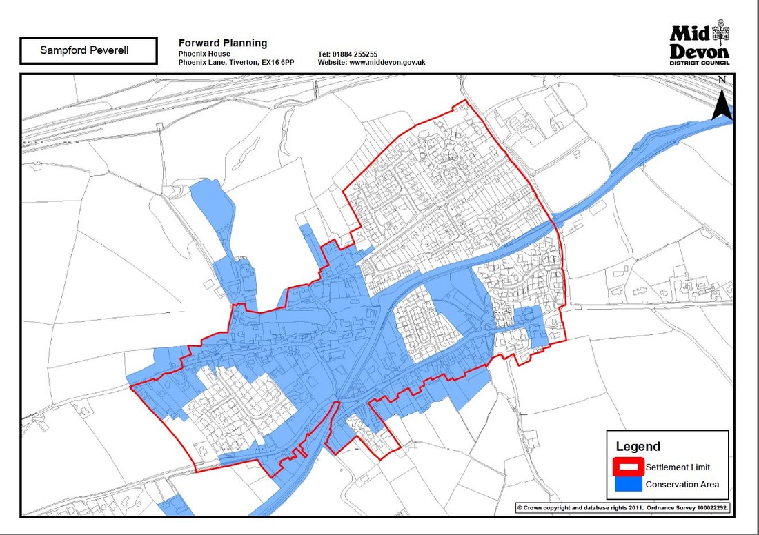
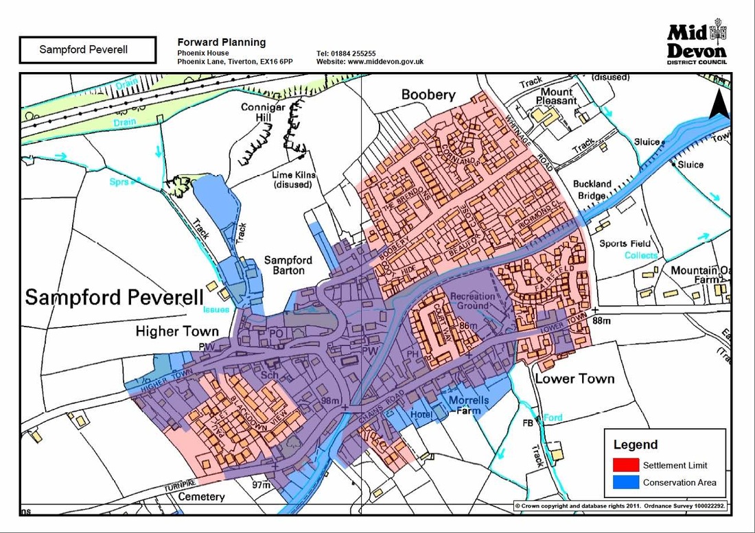
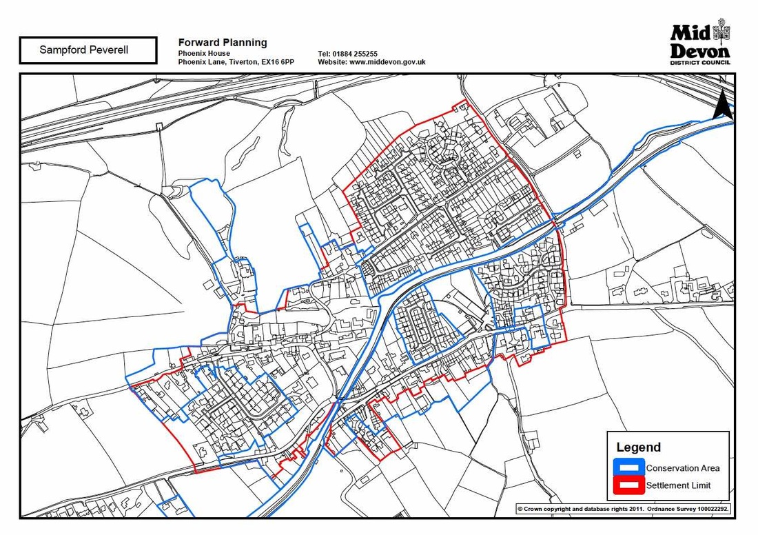
MDDC 2011 maps of Sampford Peverell

These 2011 MDDC maps show (in three different ways) the settlement limit and conservation area in the village.  Click on them to see them slightly bigger
Map of Sampford showing settlement and conservation areas
Map showing conservation and settlement areas
Sampford Peverell Parish Council
Contact us
Home page